Atlas# 3 Area of Town: Beaches and Intracoastal
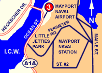
4870 Ocean St. (Map It)NOTE: will be closed Feb. 20 & 21 for parking lot repairs. All vehicles and trailers must be removed by midnight on 2/19.
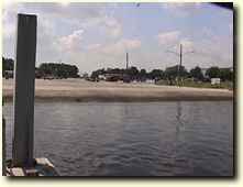
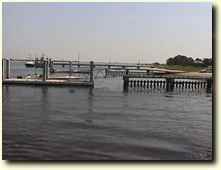
Mayport Boat Ramp is used almost exclusively by boaters heading offshore and to the Mayport jetties for fishing. It is the largest ramp in Duval County and can handle the largest trailerable boats. Some shoaling has been reported just off the base of the ramp, however this is only a problem for the largest boats at very low tides. Recent improvements have alleviated many of the problems of overcrowding, although parking is still tight on busy weekends. Swift currents make loading and unloading boats challenging during extreme conditions. The sometimes difficult water conditions and crowds may intimidate less experienced boaters who may use Intracoastal (4) or Oak Harbor (8) ramps.
Click here to link to the NOAA website for weather conditions and tide reports.
|
  |
DRIVING DIRECTIONS:
From Atlantic Blvd. Eastbound at ICW:
1. Take the ramp towards MAYPORT NAVAL STATION.
2. Turn LEFT onto FLORIDA BLVD/FL-A1A.
3. FLORIDA BLVD/FL-A1A becomes FL-A1A/MAYPORT RD
4. Turn LEFT onto FL-A1A.
5. FL-A1A becomes FL-A1A/OCEAN ST.
6. Go Past Ferry, Ramp is on Left |
 |
| PROVIDES ACCESS TO: |
NUMBER OF TRAILER PARKING SPACES: |
| Lower St. Johns River; Atlantic Ocean |
75 |
| OVERFLOW PARKING: |
DOCKING AND STAGING: |
| Some available in area |
4 floating docks |
| ADA ACCESSIBLE: |
HOURS OF OPERATION: |
| Yes |
24/7
|
| NUMBER OF RAMP LANES: |
AMENITIES: |
| 6+ |
rest rooms, picnic area |
| COORDINATES: |
|
| N 30° 23.793' W 81° 25.681' |
|
| SPECIAL CONDITIONS: |
VESSEL USE RATING: |
| Strong currents; very busy ramp; closest ramp to Ocean; full capacity during Greater Jacksonville Kingfish Tournament week in July. |
A (unlimited) |
| VESSEL USE RATING GUIDE |
A= unlimited;
B= vessels less than 22 Feet |
C = jon boats and jet skis;
D= hand launch only |
|